

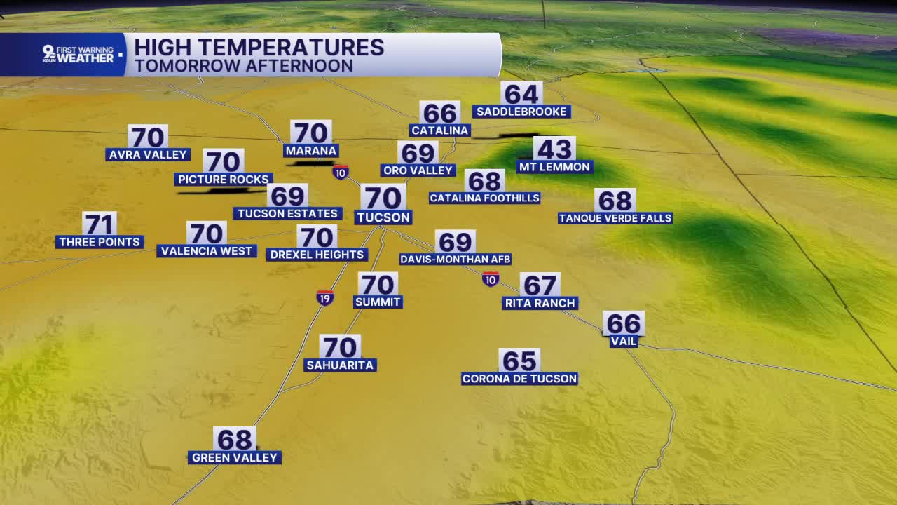


TUCSON, Ariz. (KGUN) — A cold front has swept across southern Arizona and has brought wind, rain, thunderstorms and cooler temperatures just as we get ready to go into the weekend.
Fortunately, the front will quickly move to the east and only leave behind some lingering showers over central Arizona and the White Mountains for Saturday.
Most of southern Arizona will see mostly cloudy to partly cloudy skies with high temperatures near 70° for Saturday afternoon.
Sunday will bring more sunshine with morning lows near 50° and afternoon highs in the lower 70s.
Monday, breezy conditions return with highs in the upper 70s as we prepare for another weather system to bring some more showers and thunderstorms to southern Arizona on Tuesday.
Another round of showers and thunderstorms arrives Tuesday with some gusty wind and high temperatures in the lower 70s.
Clearing skies and cooler air will follow with overnight lows dipping into the mid to upper 40s and daytime highs staying in the upper 60s to near 70° through the middle of the week.
Have a great, safe weekend!
Cochise County Forecast
——-
Cuyler Diggs is a KGUN 9 Meteorologist. Cuyler has been forecasting the weather in southern Arizona since 2003. He has experience forecasting and covering all kinds of weather since becoming a weather anchor in 1996. Share your story ideas and important issues with Cuyler by emailing cuyler.diggs@kgun9.com or by connecting on Facebook and X.

MORE WEATHER
WEATHER STATS AND FACTS
