

TUCSON, Ariz. (KGUN) — A storm is moving closer to southern Arizona and will bring a wintry mix of weather as we end the week and head into the weekend.
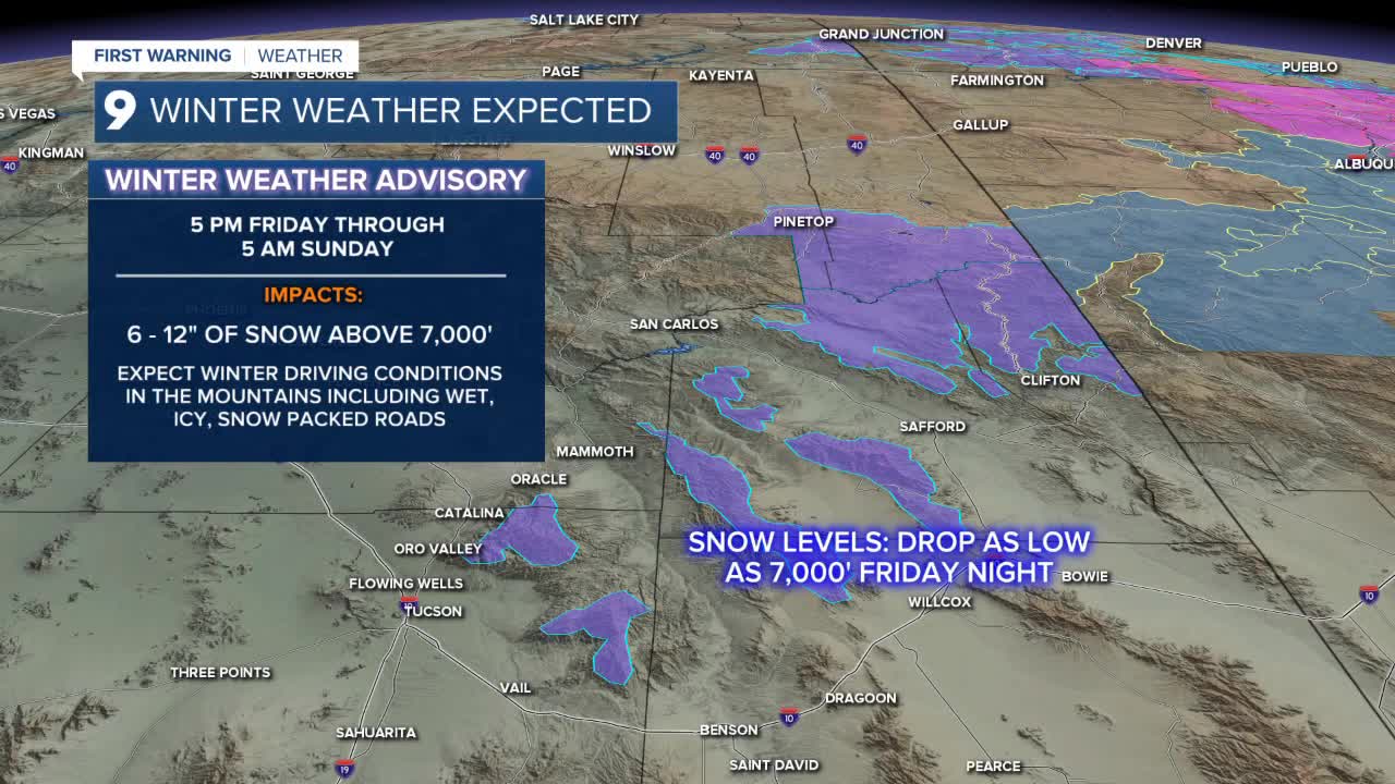
Winter Weather Advisories have been posted for the White Mountains and the mountains of southeastern Arizona where up to a foot of snow could fall above 7,000’.
Some good rainfall is expected with this storm as most lower elevations are forecast to see totals between a half-inch and an inch from Friday through Sunday morning.
High temperatures will drop into the upper 50s to lower 60s as the storm passes and low temperatures will drop into the upper 30s by Sunday morning.
The storm moves east and will leave behind even cooler air to start the week with morning lows dropping into the low to mid-30s to begin the week.
High temperatures return to the upper 60s to near 70° through the middle of the week with overnight lows climbing back into the upper 30s to lower 40s.
Dress warm and allow extra travel time over the next couple of days!
Cochise County Forecast
MORE WEATHER
WEATHER STATS AND FACTS
