

TUCSON, Ariz. (KGUN) — Nice winter weather will continue through the middle of the week before an unsettled weather pattern arrives as we begin the weekend.
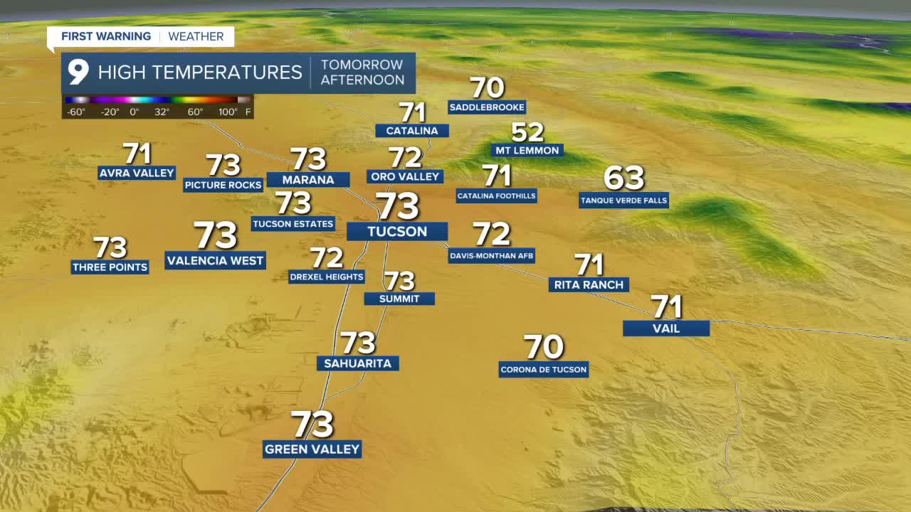
High temperatures will stay in the lower 70s and overnight lows will drop into the lower 40s through the middle of the week before cooler temperatures arrive Friday.
Moisture will increase through the end of the week with the best chance of showers occurring from late Thursday night through early Sunday morning.
Snow will be possible above 7,000’ with total accumulation between 4 and 8” above 7,500’.
Rain totals will run between 0.10” and 0.50” for most lower elevations with a few areas receiving just a bit more before the stormy weather moves out Sunday morning.
High temperatures will drop into the lower 60s over the weekend and overnight lows will drop into the upper 30s to lower 40s to start next week.
An interesting stretch of weather is on the way!
Cochise County Forecast
MORE WEATHER
WEATHER STATS AND FACTS
