

TUCSON, Ariz. (KGUN) — Our busy weather pattern continues as a series of low pressure systems moves across the Desert Southwest.
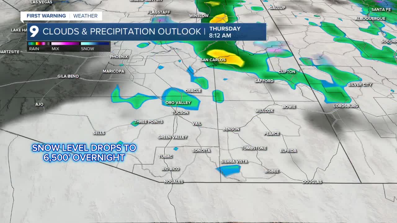
Our latest system is bringing rain, a few thunderstorms and even some mountain snow to southern Arizona.
Early Thursday morning, snow levels will drop to 6,500’ with 2 to 6” of snow expected above 7,500’.
Cool temperatures will stay with us as Thursday will only bring a high of 60° which will lead us into a chilly Friday morning with lows in the low to mid-40s.
Freeze Warnings have been posted for higher elevations to the south, southeast and east of Tucson early Friday morning where lows could dip as low as 24°.
Saturday, another low pressure system will bring a few more showers with additional accumulation of 0.10” to 0.25” expected.
By Monday, we return to a quieter weather pattern with warmer air on the way that will have us back in the lower 70s just before Thanksgiving.
Cochise County Forecast
MORE WEATHER
WEATHER STATS AND FACTS
