


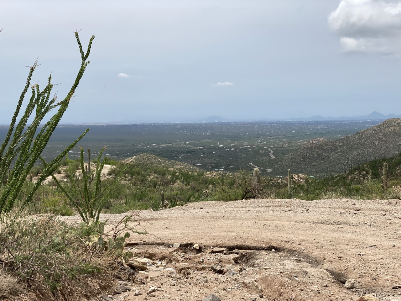
TUCSON, Ariz. (KGUN) — "The views are spectacular and we have an ability to see almost a hundred miles. You can see the Kitt Peak Observatory from here," said Doug Nutter, who lives just off Redington Road. "You can look over the entire Saguaro National Park range. So, beautiful vistas. Lots of places to hike."
Nutter is also the president of the Friends of Redington Pass. It's a group that works with the U.S. Forest Service and Arizona Game and Fish to help protect and expand recreation opportunities. They sponsor a twice-a-year cleanup of the area.
"We'll take out maybe a ton of trash every six months," Nutter said. "But it's gone down because as we've kept it cleaner people are keeping it clean."
The area hasn't always been a part of the Coronado National Forest -- and it hasn't always been called Redington Pass.
"Originally, this area was known as Cebadilla and Cebadilla Pass," said Nutter. "Cebadilla is really a native plant like a wheat that was used by the indigenous natives here to harvest and make breads."
On the other side of the pass is the San Pedro Valley. In the mid-1870s, New Yorker H.T. Redfield settled in the valley. By 1879 the settlement known as Redfield tried to establish a post office. But the name Redfield was rejected. Redington was suggested instead, and the old road became know as Redington Road. It wasn't much of a road, but it cut the 100-mile trip to Tucson into a 30-mile trip.
"A hundred and thirty years ago they were taking mule train buckboards across all day. It was a day trip. Take up your mules and come over this road in worse condition on the buckboard," Nutter said.
By the 1890s, the road fell into disuse and deteriorated.
In the early 1930s, as part of FDR's New Deal, the Civilian Conservation Corps rebuilt the road, taking it from an old stagecoach route, to the graded dirt road it is today.
Redington Road is still a bit rough. Drivers need to take it slow.

Many Tucsonans know it as the dirt road to the awe-inspiring Tanque Verde Falls. It's a prime hiking spot in the natural saddle between the Santa Catalina and Rincon Mountains.
"It's a popular area. It also can be a dangerous area," Nutter said. "We really appreciate the SARA, Southern Arizona Rescue Association, who risk their lives to bring in helicopters and climbers to pull people out who have succumbed to heat or are in danger of drowning from a flash flood."
The Friends of Redington Pass also promotes safety at the falls. That's why they've helped with a new forest service enhancement project to make improvements to the parking areas at the falls and to build trails to new overlooks.
"So you can see the beauty without going down deeper and to hike and walk around it. To park and ATV, to have a picnic, to have a ramada," Nutter said. "So we really want the people of Tucson and Pima County to enjoy this -- their backyard."
Redington is spelled with just one D, although some Pima County maps and street signs showed it with two D's for many years.
In the mid-1990s the correction was made to Redington with one D.
——-
Pat Parris is an anchor and reporter for KGUN 9. He is a graduate of Sabino High School where he was the 1982 high school state track champion in the 800 meters. While in high school and college, he worked part-time in the KGUN 9 newsroom. Share your story ideas and important issues with Pat by emailing pat.parris@kgun9.com or by connecting on Facebook, Twitter, and Instagram.


