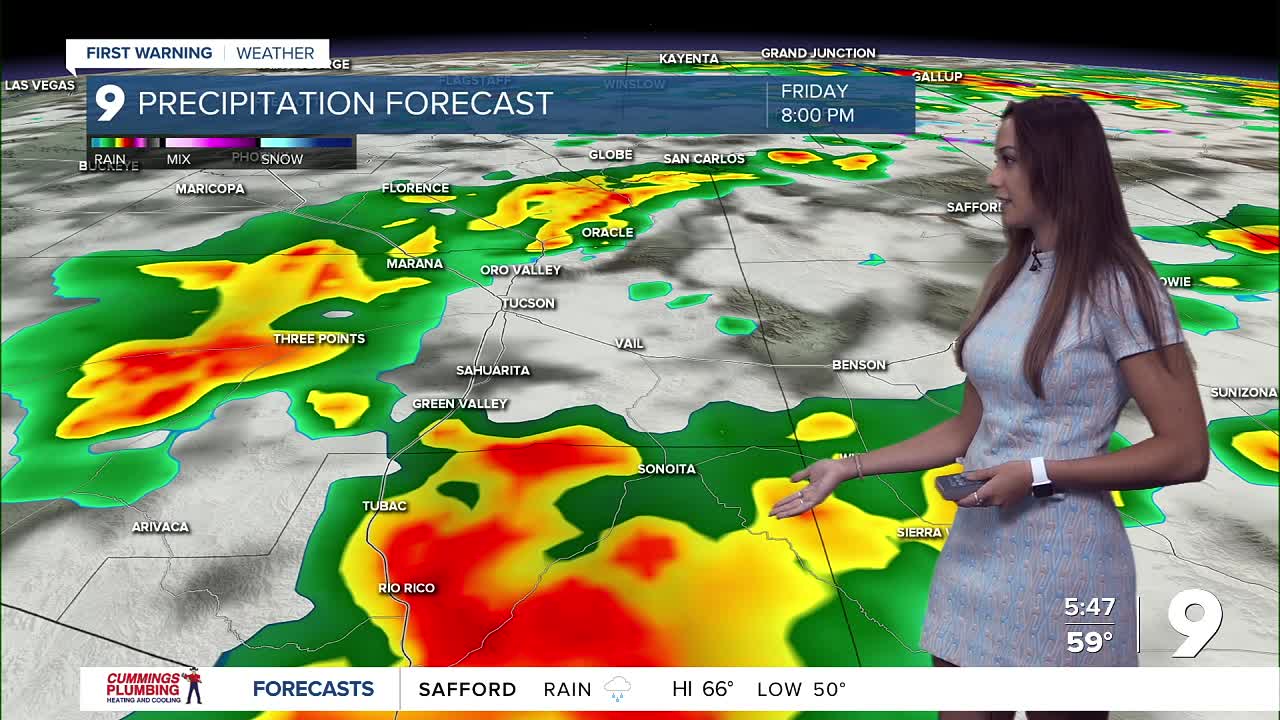


TUCSON, Ariz. (KGUN) — Rain and high-elevation snow are expected across Southeast Arizona today as a weather system moves through the region, with a slight chance of isolated thunderstorms. Valley areas will see mostly light to moderate rain, though a few spots could pick up locally heavier downpours that may lead to minor street or small stream flooding. Flash flooding is not expected. Most valley locations will receive less than a third of an inch of rain, but isolated areas could see up to 1 inch. Cloud cover and rain will keep afternoon highs 4 to 12 degrees cooler than Thursday.
In the mountains, totals between a half-inch and 1 inch of liquid are likely, with up to 4 inches of snow above about 7,500 feet. Snow levels will drop to near 8,500 feet by late morning.
Dry weather returns Saturday afternoon and continues through Sunday, with temps reaching to the 70s across the valleys by the end of the weekend. Another storm system is expected to move in late Monday through early Wednesday, bringing a 40% to 60% chance of rain, especially late Monday night into Tuesday morning.
MORE WEATHER
WEATHER STATS AND FACTS
