
TUCSON, Ariz. (KGUN) — Southern Arizona heads into Wednesday with a familiar setup: strong high pressure parked over the region, keeping skies clear and temperatures on a steady climb.
That ridge will continue to push daytime highs upward through the end of the week, bringing several days of near-record warmth for early December.
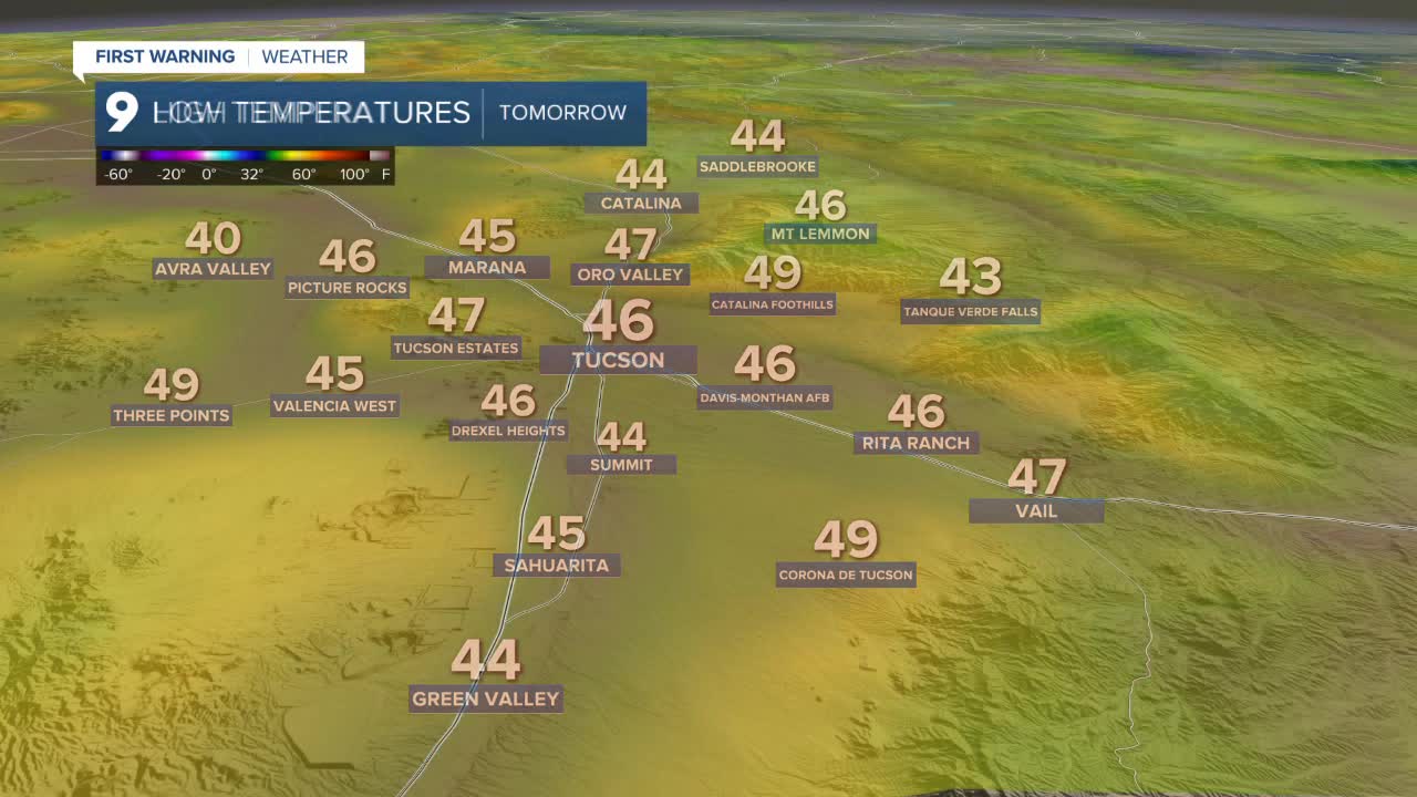
Overnight, the cool mornings stick around. Tucson is expected to dip into the mid-40s again, bottoming out near 46 degrees early Wednesday. Much of Southern Arizona follows the same trend, with Sierra Vista starting the day around 44 degrees.
Afternoon temperatures jump quickly under sunny skies. Most communities will land in the 70s, with Tucson topping out near 79 degrees — close to the daily record. A few spots, including Organ Pipe and Sells, are expected to reach 80 degrees. Sierra Vista should see a high near 73 degrees.
Tucson’s upcoming record highs for comparison:
Wednesday: 82° (set in 1950)
Thursday: 83° (set in 1939)
Friday: 79° (set in 2004)
----
MORE WEATHER
WEATHER STATS AND FACTS
