



TUCSON, Ariz. (KGUN) — Scattered thunderstorms are expected to develop again Sunday afternoon and evening across Southeast Arizona, bringing the potential for severe weather.
Any stronger storms could produce damaging wind gusts, blowing dust, hail and flash flooding.
Thunderstorm chances are expected to continue each day through the upcoming week, though the exact locations and severity of storms will vary from day to day.
High temperatures are forecast to remain around to slightly below normal beginning Monday.
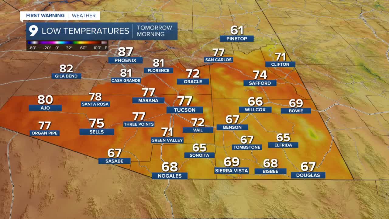
Sunday morning will start warm across much of Southern Arizona.
Tucson is forecast to wake up to a low around 77 degrees, while many communities across Pima County will see overnight lows in the upper 70s. Some locations could remain in the low 80s through the early morning hours.
Across Cochise County, temperatures will be slightly cooler. Sierra Vista is expected to see a low near 69 degrees, while much of the county wakes up to temperatures in the mid to upper 60s.
Despite the potential for afternoon thunderstorms, temperatures will still climb into the triple digits across many lower elevation communities.
Tucson is forecast to reach a high near 103 degrees Sunday afternoon.
Across Cochise County, Sierra Vista is expected to top out around 92 degrees, while many surrounding communities warm into the 90s.
----
MORE WEATHER
WEATHER STATS AND FACTS
