
TUCSON, Ariz. (KGUN) — Scattered thunderstorms are expected across southeast Arizona on Monday, bringing the chance for brief but locally heavy rainfall.
The weather pattern is expected to continue into the early part of the workweek, with isolated to scattered showers and storms possible each day. Intensity and coverage will vary from day to day.
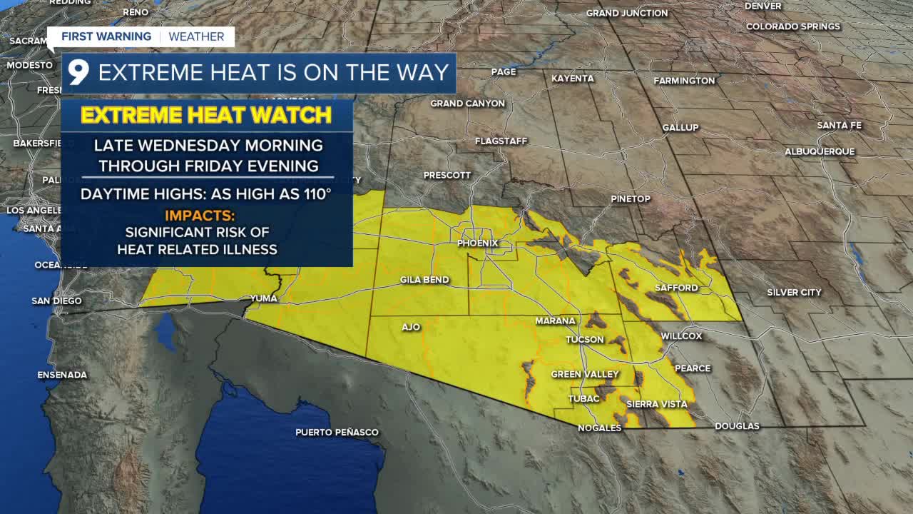
By midweek, the focus shifts from storms to soaring temperatures. An Excessive Heat Watch is in effect from Wednesday morning through Friday evening, with high temperatures forecast between 105 and 110 degrees.
Overnight lows will remain warm in the Tucson metro, hovering in the upper 70s, while Cochise and Santa Cruz counties will see cooler mornings in the 60s. Sierra Vista is expected to dip to around 69 degrees.
Daytime highs will stay hot for most of the region. Tucson and much of Pima County are expected to reach at least 100 degrees. Sierra Vista and other areas in Cochise County can expect highs in the 90s.
----
MORE WEATHER
WEATHER STATS AND FACTS
