



TUCSON, Ariz. (KGUN) — Southern Arizona gets a few dry, warmer days this week before showers and thunderstorms return late Thursday, with the potential for heavy rain next Sunday.
After a cooler-than-normal Sunday, afternoon highs warm to near or slightly above normal Monday through Thursday. Temperatures drop back below normal Friday and stay there through the weekend.
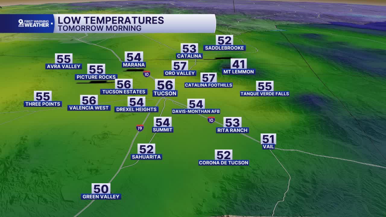
Monday morning starts crisp, with lows in the 50s across much of the Tucson metro. Tucson drops to 56 degrees, while Oro Valley and the Catalina Foothills bottom out at 57. Marana starts at 54, Sahuarita and SaddleBrooke at 52, Vail at 51 and Green Valley at 50. Mount Lemmon dips to 41.
By Monday afternoon, highs reach the mid-80s. Tucson tops out at 85 degrees, with Oro Valley, Marana and the Catalina Foothills at 84. Sahuarita and Green Valley reach 83, Vail hits 79 and SaddleBrooke climbs to 75. Mount Lemmon stays cool at 58, and Phoenix reaches 84.
Southeastern Arizona starts the day even cooler, with Monday morning lows in the upper 40s and low 50s. Benson drops to 46 degrees, Tombstone, Elfrida and Sonoita to 47, and Willcox to 48. Bisbee, Douglas and Nogales start at 50, while Sierra Vista and Bowie bottom out at 51.
Monday afternoon highs climb into the upper 70s and low 80s. Douglas reaches 80 degrees, Elfrida 79, and Sierra Vista and Tombstone 78. Willcox, Benson and Bowie top out at 77, and Bisbee reaches 75. Nogales climbs to 81 and Sonoita to 77.
Dry conditions hold across the region through Thursday. Showers and thunderstorms move back in late Thursday and stick around through the weekend, which could affect Halloween plans Saturday. The heaviest rain is possible Sunday.
----
MORE WEATHER
WEATHER STATS AND FACTS
