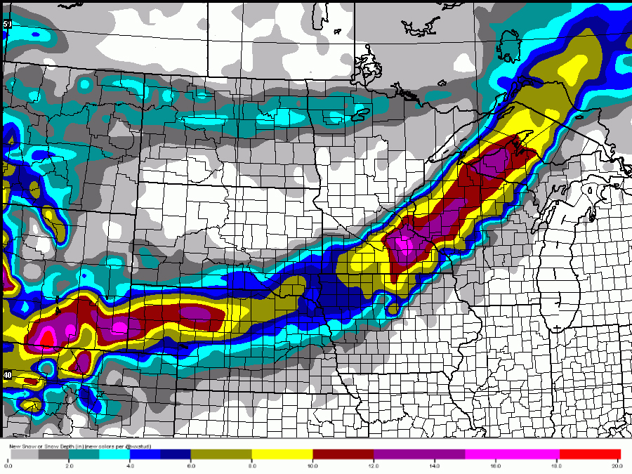
After almost a week of record-breaking, or at least near record-breaking temperatures, it's hard to believe something like a blizzard is going to cut across the country.
Beginning on Thursday, a strong low pressure system is expected to develop in eastern Colorado over the Plains. That storm system will strengthen quickly, and begin to pull in some of the colder air over the Northern Rockies.
RELATED: Storm Shield app provides life-saving weather alerts
RELATED: SnowCast tells how much snow will fall at your location
From there, the winter storm is likely to travel across the Plains and into the Upper Midwest. Nebraska, South Dakota, Minnesota, Iowa and Wisconsin are most likely to bear the brunt of the storm with the heaviest snow and the strongest winds.

The cold air, snow and brisk winds are going to give many areas a taste of winter after feeling spring's warmth for almost a week.
The warmer air ahead of this winter storm will help to feed chances for thunderstorms in the Midwest and the Southeast on Thursday and Friday. Some of those storms could even be severe.
Once this storm passes, some much colder air is returning to the eastern two-thirds of the country over the weekend.
RELATED: This is why you're sick when it gets cold!
It seems winter isn't finished yet, even if it felt like it for an entire week in February.
Follow Storm Shield Meteorologist Jason Meyers via the Storm Shield app on Twitter, Facebook, and YouTube. Download the Storm Shield Weather Radio App for your iPhone or Android device and get severe weather alerts wherever you are. Named by Time.com one of the best weather apps for your iPhone.
