


TUCSON, Ariz. (KGUN) — In parts of Tucson, flooding and erosion aren’t just occasional inconveniences — they’re ongoing challenges. The Pima County Regional Flood Control District is mapping out long-term solutions for the Brawley Wash watershed to help protect homes, roads, and the environment.
It's a collaboration with the National Resources Conservation Service (NRCS) and other stakeholder groups.
The Brawley Wash watershed stretches from Pinal County down to Three Points in Pima County, covering nearly 200,000 acres. During monsoon, the area can transform from dry ground into fast-moving floodwater.
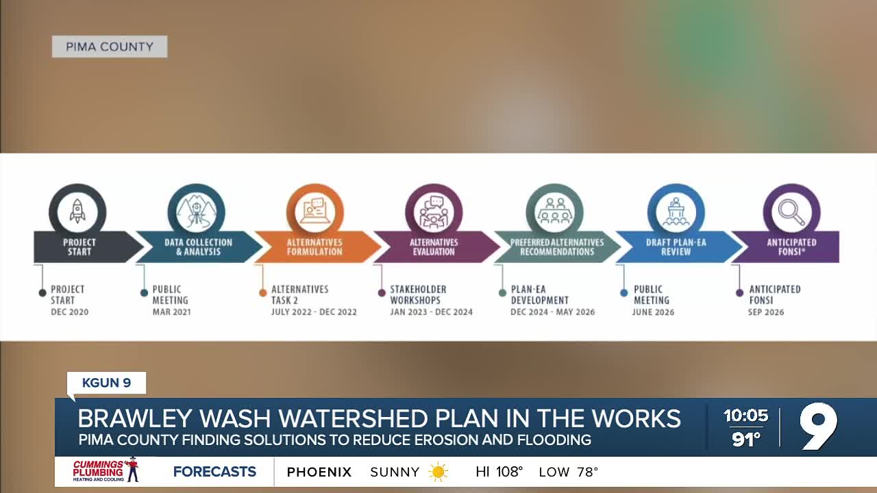
The Brawley Wash Watershed Plan/Environmental Assessments (Plan/EA) has been in development since 2020 and is on its way to completion.
According to Camille Hall, community engagement manager for the Pima County Regional Flood Control District, the county has been assessing how drainage patterns have changed over time and how that affects the surrounding community.
"So over the course of many, many, many years in the Brawley Wash watershed, there's been lots of development. This has included residential homes, public infrastructure, and agricultural lands, and all of this development has changed the natural drainage patterns in the watershed," Hall said.
Because of that development, the county is working to find better ways for water to flow without causing damage.
"We were looking at how the patterns exist now today, potential areas where water builds up, where there's excess erosion, those sorts of things, and we're looking for solutions on public land to mitigate those risks," Hall said.
Out of seven areas examined and analyzed, the county identified three areas where action could be taken and have potential solutions it may move forward with.
"So what this looks like in a lot of areas there have been earthen berms in agricultural land that has been built up that kind of causes the water to pool and causes excess erosion. So a potential solution in areas like that would be essentially cutting parts of the berm away to allow that water to go through and permeate that area," Hall said.
The next step in this NRCS grant-funded project is to work with the U.S. Department of Agriculture (USDA).
"To make sure that there are no adverse impacts to public infrastructure, private residents, cultural resources, or agricultural lands before we move forward with any of these solutions," Hall said.
A public meeting was held this month to inform and hear from community members about the progress and potential solutions. The last day for public comment on the Plan/EA is June 23, 2026.
This story was reported on-air by a journalist and has been converted to this platform with the assistance of AI. Our editorial team verifies all reporting on all platforms for fairness and accuracy.
——
Vanessa Gongora is KGUN 9's Westside reporter.. Vanessa fell in love with storytelling by growing up in sports. She was fascinated by how sports reporters go beyond the x's & o's to tell players' stories, and how sports bring people together, inspiring Vanessa to provide the same impact as a journalist. Share your story ideas and important issues with Vanessa by emailing vanessa.gongora@kgun9.com or by connecting on Facebook, Instagram, and X.

----
STAY IN TOUCH WITH US ANYTIME, ANYWHERE


