


BUCKEYE, AZ — Firefighters are continuing to battle the Hazen Fire burning in the West Valley near Highway 85.
The fire sparked on Saturday afternoon and, as of Monday morning, the fire is estimated at 980 acres. It remains 0% contained.
See a Monday morning update from fire officials in the video player below:
There are no evacuations in place and no reports of damage to homes or structures in the area at this time.
"Some residents may choose to leave the area on their own based on their personal comfort level. Evacuations are issued by the Maricopa County Sheriff’s Office," Arizona Department of Forestry and Fire Management officials said Monday morning.
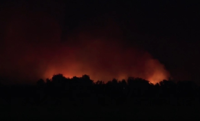
See aerials of the fire on Monday morning in the video player below:
Around 3 p.m. Saturday, firefighters were first called to the area near Hazen and Rooks roads for a six-acre fire. By 7 p.m., officials announced the fire had quickly grown to more than 270 acres.
The fire is burning in the Gila River bottom and is difficult to access, according to the Buckeye Fire Department. Due to positioning, firefighters are allowing the fire to burn through "available fuels in a controlled manner while maintaining containment lines."
Officials have also said that windy conditions and the type of vegetation that is burning, including cedar, are creating firefighting challenges.
The fire is said to be burning toward the east, and the fire line is holding on the western side. Additional crews have been ordered to fight the blaze, officials said Monday.

As a precaution on Saturday, the Buckeye Police Department and Department of Public Safety shut down the northbound side of Highway 85 due to the fire's movement and potential impacts on visibility and roadway safety. The highway has since reopened.
Arizona Public Service also de-energized power lines in the area as a safety measure. There has been some reported damage to the electrical infrastructure; however, the extent of outages is unknown.
The cause of the fire is under investigation.
Hazen Fire Morning Update for May 4:
— AZ Dept. Forestry and Fire Management (@azstateforestry) May 4, 2026
980 acres and 0% contained.
A Temporary Flight Restriction (TFR) is in effect for the fire area. This restriction applies to all aircraft, including drones, that are not assigned to fire suppression efforts. Any unauthorized aircraft… pic.twitter.com/fQVPaPPS2i
